
A company commander, a helicopter pilot, a JTAC, a reconnaissance element, and an assault team all attend the same briefing and leave with a different picture of the mission.
It is the consequence of how humans process spatial information. Research into spatial problem-solving shows that 3D environments yield superior memory outcomes compared to 2D.
For decades, military planning has relied heavily on 2D maps, overlays, and PowerPoint briefings. These methods remain effective because they have proven their value over time.
The challenge appears when information moves beyond the planning cell.
Planners may spend hours analysing routes, studying terrain, discussing alternative courses of action, and identifying constraints. The final briefing compresses all that detail into a short session for a much larger audience. Every participant is expected to reconstruct the same operational picture, timelines, and synchronisation points in their own head.
Some can. Others cannot.
The difference remains invisible until execution, where adaptation becomes expensive and mistakes carry consequences.
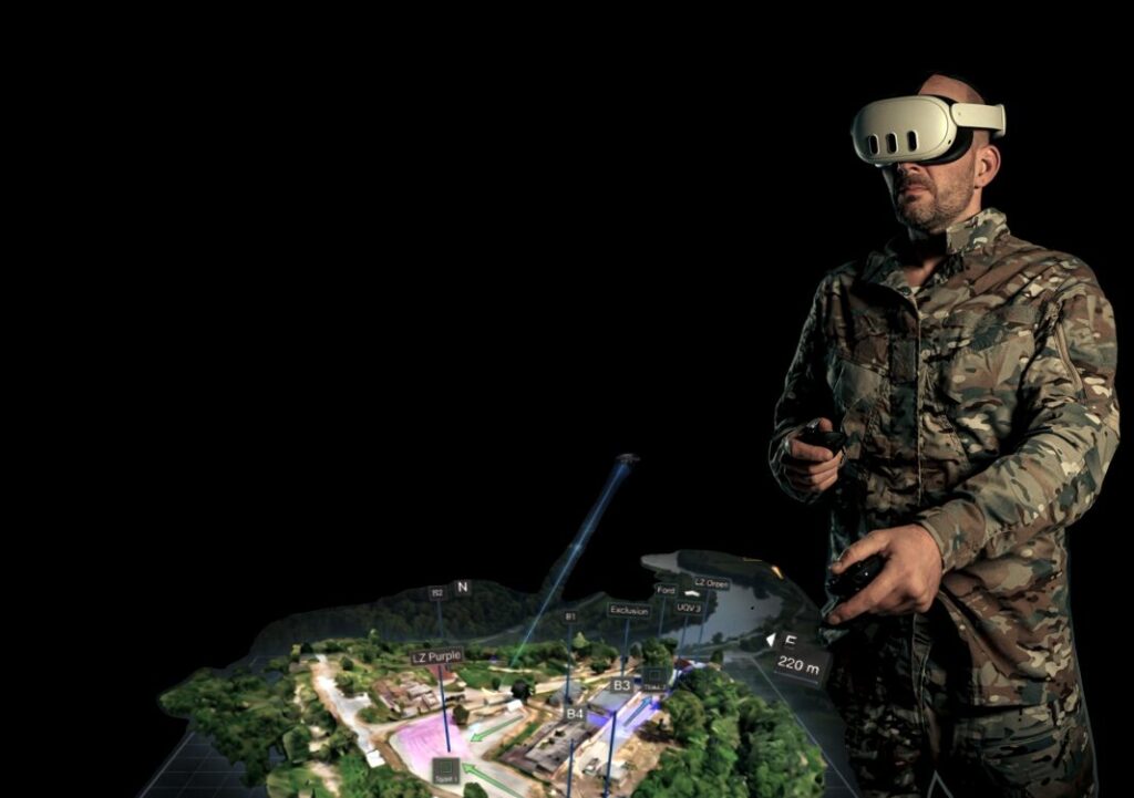
The 3D advantage: Future Memory
A ridgeline on a map does not communicate dead ground. A route that appears clear on a slide may conceal a ditch, a wall, a fence line, or a slope that stops a vehicle. Every obstacle that lacks a symbol on the map goes unseen. In 3D, the terrain speaks for itself.
Changing the setup
Planning follows a pattern. Teams analyse the mission, develop courses of action, conduct a briefing, and move towards execution.
RE-liON’s Mission Planning Module supports that process seamlessly. Satellite and aerial imagery can be used alongside last-minute drone imagery and video feeds.
Academic research confirmed the value of this approach in land, air, and maritime exercises as early as 2018. What once required large compute infrastructures is now available in a deployable operator kit.
It enables teams to analyse mission objectives in a realistic three-dimensional representation of the operational environment. Routes, objectives, landing zones, engagement areas, terrain restrictions, and contingency options can be explored from the perspective of the people who will ultimately execute the mission.
Technology evolves. The purpose of planning does not.